Manhattan Chinatown
A Guide for Tourists
Maps and Geography
Chinatown is located on the lower portion of Manhattan. It consists of two square miles of shops, homes, restaurants, and much more for the Chinese community.

Various Maps of Chinatown NYC
The boundaries of Chinatown are fluid. Depending on who is asked and the context in which they are asked, that one person may provide a variety of answers. Traditionally, the borders of Chinatown can be considered as: Canal Street in the north, The Bowery in the east, Worth Street in the south and Baxter Street in the west. However, these are strictly geographical and do not take into consideration the expansion of the Chinese community in New York.

In the late 19th century, Chinese immigrants lived in a tight community and the boundary of Chinatown was very clear. However, over the years, with people moving in and out of the area and zoning changes by the city, the boundaries of New York’s Chinatown is no longer so clear. Currently, Chinatown is pressing up against Little Italy and Lower East Side without much more room for expansion. Justin Yu, president of the Chinese Consolidated Benevolent Association stated that people feel very strongly about their neighborhoods, “For example, in Little Italy, most of the landlords are Chinese. But can we call Little Italy part of Chinatown? I don’t think so.”
People are normally matter-of-fact about where the borders are, but when policy changes are proposed and certain people have to pay more if they are classified as either being “inside” or “outside” of Chinatown, then they become much more vocal about where they think Chinatown begins and ends. The truth is, there has not been in well-defined border of Chinatown in over half a century. In the late 19th century, Chinatown was an immigrant community clustered around the Five Points district, now called Columbus Park. Slow growth until the middle of the 20th century meant boundaries pretty much remained fixed: Canal Street to the north, the Bowery to the east, Worth Street to the south and Baxter Street to the west. With the Immigration Act of 1965, the size of the Chinese community exploded, leading to encroachments on borders throughout the 1970s, and again throughout the 1980s as entire families immigrated to the US.

How Do I Get There?
Subway:
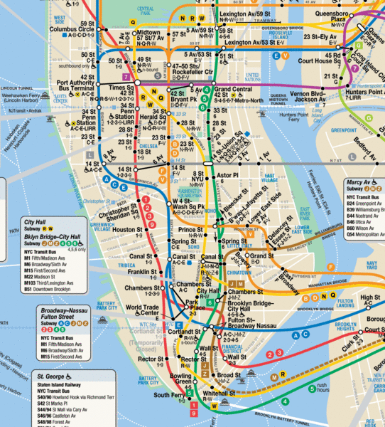
From Manhattan’s east side, take the 6 train to Canal Street station and the 4 or 5 train to Brooklyn Bridge. From Manhattan’s west side, take the B or the D train to Grand Street station. From Queens, take the Z train to Canal Street. From Brooklyn, the D, B, N, Q, R, J, M, and 6 trains all stop at the Grand Street or Canal Street stations.
Bus:
The M-15 bus runs south on 2nd Avenue to Chatham Square. The M-102 and M-101 run south on Lexington Avenue to Bowery Street to Chatham Square. The M-6 bus runs south on Broadway to Canal Street.
Car:
From Long Island, take the Brooklyn-Queens Expressway to Manhattan Bridge to Canal Street. From New Jersey, take the Holland Tunnel to Canal Street.


The People's Perspective
Furthermore, when community members are asked what they think the boundaries of Chinatown are, there are a variety of interesting answers. The following quotes are taken off of a forum on “Tripadvisor” and show some of the ways that people define New York Chinatown’s borders. These are statements made in response to the question “What are the boundaries of Chinatown?”
“I don't know if there are formal boundaries…”
“Chinatown has very fluid boundaries that really can't be pinned down. It seems to get larger every day.”
“The boundaries ... ah… get off the train at Canal Street and just keep walking till you stop seeing Asian people anymore.”
“I'm not sure of the boundaries, but it felt like it went on forever. I was so sad on my first trip to see that most of Little Italy feels like Chinatown!”